Thursday, 29 September 2011

West Island Way. Rothesay on the Island of Bute. September 2011

Todays transport .

In English and Gaelic

Victorian toilet block on the pier.

Rothesay Castle including moat.

The Winter Gardens

The Kilmarnock Rocket plus the teacher having lunch.

Not to be confused with these two friendly guys.

A polite way of getting the message across.

Wemyss Bay's wonderful railway station.
Today along with the Kilmarnock Rocket accompanied by the school teacher we crossed by ferry from Wemyss Bay to Rothesay on the Island of Bute to walk part of  the West Island Way. Arriving on the island we caught the local bus to Kilchattan Bay about 8 miles from the main town. On a very cloudy misty morning we set off along a track towards the airfield and this is where the  poor preparation came in coupled with the lack of a map we took the wrong turning and finished up on a hard road before a friendly farmer put us back on path through a golf course onto the shore. After another 2 miles along the beach we decided we had gone wrong again so headed up towards a farm which turned out to be a stables. A nice young lady corrected us again and finally  picked up way signs and now we were off on the right path. Nae fun if you have all these fancy gadgets for location and maps to assist you we got there in the end albeit with a wee detour! Up past a cairn on the top of a hill we could see through the mist a track meandering its way across the moor hopefully towards Rothesay town. The cloud and mist lifted in the afternoon to help us navigate safely back to the start.Great day out but we all agreed next time we should take a map or better still invite the pilot to accompany us he always knows the way and never gets lost!!

Tuesday, 27 September 2011

Cunninghame ramblers mid walk to Loudoun Hill from Darvel September 2011

Walkers met at the Ranoldcoup Car Park in Darvel.

Old railway line from Darvel to Strathaven in Lanarkshire.

One of many fine bridges on this stretch of line.

Loudoun Hill (316M)

A view from the summit down the Irvine Valley.

"William Wallace Monument"

This householder collected old parts of electric power lines.

Including this fine railway lampost.

Today's group .

This fine 79 year old retired policeman was our leader.
Today Tuesday September 27 I once again joined up with the Cunninghame group of ramblers on their mid-week walk from the old lace town of Darvel to Loudounhill which lies a few miles  east of the town.17 of us set off on a cloudy windy but dry day along an old railway line that once ran to Strathaven and probably onto Hamilton to join up with the lines to the South. Our leader told us that it closed in the early fifties when he was a police constable in the area at this time.(He became a detective chief inspector later on in his career)The line is fairly overgrown with a few patches of nettles to negotiate which two of our group found a wee bit difficult as they were wearing short trousers. When will they learn to dress properly for the conditions.Arriving at Loudounhill it was a short very steep climb to the summit with its wonderful views down what is known as the Irvine valley. Coming down the hill was fun with a few of us slipping on the wet grass before we made our way to an unusual monument to William Wallace. The leader gave us a brief talk on the history of the Battle of Loudoun in 1307 which was very interesting. Crossing over the A71 we had a mile of road walking before entering a moorland area where we stopped for lunch. Passing down a river path we arrived back at the cars to end an 8 mile walk with lots of local history stories from the leader including some with a poacher element in them that kept us all amused. Many thanks once again to everyone who was out today for allowing me to join such a fine body of ramblers.

Saturday, 24 September 2011

ADRC Finnarts Bay to Portendea. September 2011

Climbing up the Ayrshire Coastal path.

Our first view of Loch Ryan

Coffee stop on Finnarts Hill.

Looking out to Corsewall Lighthouse.

Very steep descent to Portendea.

Walkers having lunch with the sea views.

This is all that remains of the cottage.

My walks always have a tree lined avenue in them!!

The Water of App meets the sea.

Today's happy group.
Today Saturday September 24 I had the pleasure of being the walk leader to take ADRC on a historical walk to Portendea which is near to the mouth of Loch Ryan in Scotlands south west coast.25 of us met at Finnarts Bay on a lovely sunny morning and after parking the cars made our way along a forest road before we came to the Ayrshire Coastal path to take us up Finnarts Hill where once  clear of the trees the stunning coastal views began to open up. After a brief coffee break we made our way over  moorland to a path down to the bay known as Portendea. As walk leader I pointed out that we were about to descend on a fairly difficult path and great care must be taken for the safety of all walkers. Since my last visit here they have improved the road by blasting into the rock so whilst it was very steep it was not at all dangerous and we all made it down with no great difficulty being incurred.This was the site of Elsie Mackays holiday home before somebody demolished it. This must have happened fairly recently as it was only brought to my attention by a well known rambling blogger that it had been removed presumably for safety reasons.I narrated the story of the late Elsie Mackay the aviator daughter of Lord Inchcape who was tragically killed in 1928 whilst trying to fly the Atlantic.There is lots of history about this area and most of it can be found on the internet. After lunch we had the nice climb back out of the bay before making our way back down to Finnarts Bay.Again I pointed out places of interest and the various landmarks visible  towards the lovely Mull of Galloway. As is often the case it is difficult to analyse ones own walks but judging by the numbers who turned up today , the lovely weather combined with the magnificent coastal views I feel I must have got something right.

Wednesday, 21 September 2011

Girvan to Saugh Hill 10 mile circular. September 2011

The old farmhouse with the windmills in the background

Tormitchel Quarry.

A friendly lama.

Girvan town from Saugh Hill.

Magnificent floral display in Orchard Gardens.

View of Saugh Hill from Girvan railway station.
Yesterday Tuesday 20 September I travelled to Girvan to meet up with a  recently retired rambling school teacher from Newton Stewart and Stranraer who has moved to the town to enjoy his retirement.This is a 10 mile walk I have done before with ADRC and Wigtownshire ramblers so as I have blogged it already this will be a fairly short resume of our day. We climbed up Laggan Hill (269m) using the Carrick Way which was a wee bit wet underfoot . Once on the top we had some lovely views of the Clyde on a windy sunny morning.Passing through Barbie woods we came to the old farmhouse with its track down to Tormitchel Quarry. We then went along a minor road for a mile before going up Tralorg Hill over to Saugh Hill (269M) where we had our lunch stop.This is the highest part of the walk we could even see the outline of northern Ireland in the misty distance. From here it was a 3 mile walk back down the hill past Fauldribbon Farm into Girvan to end a very pleasant day in the South Ayrshire hills.

Monday, 19 September 2011

ADRC. Craignaw and the Devils Bowling Green September 2011

Today was also the Merrick annual race.
P.S. This walker did not win!!!!!

Coffee stop at the Gairland Burn.

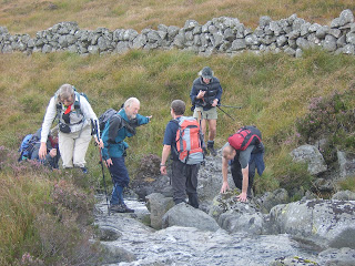
Some of us found difficulty in crossing the burn.

Including this young lady.

Loch Arron with Benyellery in the background.

Memorial to American Airmen (see text)

Parts of the airplane can still be seen.

Today's group on the summit of Craignaw (645M)

More very steep descents were undertaken by the walkers.

Me on the Devils Bowling Green.

Even managed a close up!!
On Sunday 18 September it was back to Glentrool to walk with ADRC to Craignaw and the devils bowling green which is a large granite slab left over from the glacial age.On a nice sunny morning 20 walkers made their way up the side of the Gairland Burn to Loch Valley where we had our first break to admire the hills which were silhouetted on the calm water of the loch. Our next obstacle was a burn crossing where several different ways of getting over were demonstrated by the group some successful others a wee bit more unsuccessful.As usual no names will be mentioned.Our first climb took us up to Snibe Hill before the final asscent onto Craignaw.(645M). On our way up the leader showed us the memorial stone erected in memory of two american airmen whose F-11 aardvark airplane crashed in 1979 wreckage from the plane is still visible today.At the summit we had our lunch stop where one of the group pointed out various landmarks which we could see. Isle of man,Northern Ireland,Mull of Kintyre and away in the far north Ben Lomond was also identified making for super visibility today.Steep descent took us down to an area known as the devils bowling green with its large area of flat granite. Some fun was had here rolling small round boulders across the imaginery green! Further minor scrambling was encountered on our way down to Loch Neldricken  where a famous murder hole is situated. This one was mentioned in a book called "The Raiders" by Galloway author  by S.R.Crocket.We now retraced our route back down the slippy Gairland Burn path  to the cars to end this 9 mile walk of the Galloway Hills. Thanks to the leader for taking us all on a very interesting and somewhat challenging walk on a crisp clear Autumn day.

Wigtownshire Ramblers.5 Lochs and the Merrick. September 2011

Getting prepared for the walk.

They were the first to reach the summit of Buchan Hill (493M)

"Alone on a hill"

Loch Arron.

On the Rig of Loch Enoch.

Can you see "the grey man's face in the rock"?

Climbing the Merrick.

She has the most wonderful collection of hats.

Me with a bevy of beauties.

At the top of the Merrick(843M)

One of many steep descents.

Todays leader.
On Saturday September 17 I travelled to Glentrool to meet my mother group for a walk around 5 lochs and a climb up the Merrick which is the highest hill in south west Scotland.17 of us set off from Bruces Stone car park on a clear partly cloudy morning to climb our first hill namely Buchan Hill. It was a good climb and we were all on the top fairly quickly where our leader pointed out the various lochs which had come into view. Walking along the Rig of Loch Enoch more commonly known as the Buchan Ridge we saw a young roe deer who was resting in the heather until we came trudging along it bounded off into the distance. Lunch was taken overlooking the loch before the short sharp climb of 300M up to the Merrick. We had a slight rain shower at this point but as we approached the summit the sun tried to make an appearance. Various hills were  identified as the clouds rolled by which made it a little bit different from our normal time here when it is completely shrouded in mist. Over on to Benyellery by the tourist route where most walkers thought we would continue down the normal path passed the bothy. This leader is well known for something a wee bit different when we turned off the path into the soft boggy areas and made our way over to Bennan Hill (562M) which was our last hill today before we began the very steep descent down the hillside back to the cars. The weather forecast was for lots of showers today but for once we were very lucky and only really had some light rain for a while. Thanks to our leader for taking us on a very interesting 10 mile walk albeit not the traditional routes that most of us have done before.