Sunday 30 September 2012

Wigtownshire ramblers. Culvennan Fell circular near Kirkcowan. September 2012

Leader's briefing.

And through today's arch .

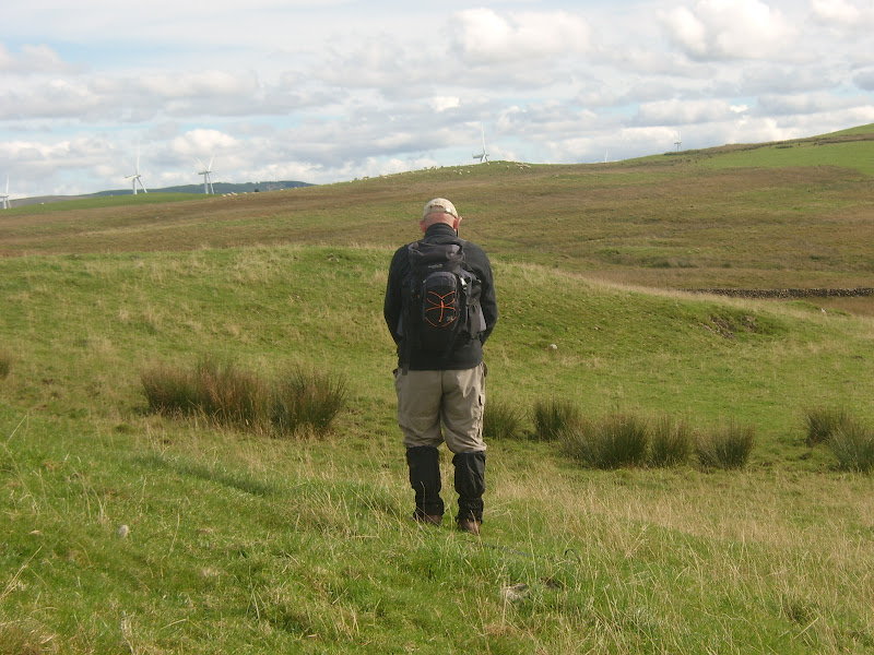
On the old Military Road.

Mud,mud and glorious mud!!

Nobody was sure what this was built for.

I always find a tree lined avenue.

This tree was precariously held up by the phone wires.

Leader helps the walkers cross the burn

Barfad Loch.


And then there was more mud.

This group provide carpet to assist you over the fence.

The infamous Newton Stewart Blogger.

They make a lovely couple.

Todays group on the summit of Culvennan (213M)

Lofty was today's leader.
Yesterday Saturday September 30th I went by bus to Stranraer and then by car to meet my mother group near Kirkcowan in Dumfries and Galloway.13 of us met on a cloudy windy morning for this 9 mile circular walk up to Culvennan Fell (213M). Firstly we started out on one of General Wade's old military roads which our leader explained to us  had been built around 1760 to allow the soldiers a road from Dumfries to Portpatrick and then by boat to Ireland.Passing Shennanton House which today has been split up into holiday lets, the walkers had a difficult time trying to avoid the mud and puddles on the tracks after all the recent heavy rain. Lunch was in a disused quarry area beside the picturesque Barfad Loch with it's little boathouse presumably for the use of the local fishermen. From here we started to climb through a forest that our leader some years ago was partly responsible for the planting of the various fir trees to take us to  the summit of Culvennan Fell where we had another short break to take in the wonderful views across the hills all the way south to the Solway coast. The final part of the walk was across moorland with a couple more fences and burns to cross before reaching the cars back at the start. A very interesting walk in an area I am not too familiar with made this a super day out,many thanks to the leader who had worked out today's somewhat muddy route around the forests he knows so well.

For a more interesting blog with some wonderful pictures of yesterday go to the Newton Stewart  bloggers page where you will find lots more information.(Thanks for the pic J.D.)

This is the walk leaders press report:

Wigtownshire Ramblers – Saturday 29 September 2012


Thirteen ramblers assembled on the Three Lochs road just north of the A75 on a morning that promised crisp autumn weather. Dark clouds to the north suggested something else but the group headed off in good spirits along the old Military Road. Some sections were wet and muddy but the solid base created under the direction of General Caulfield in the 1760s provided a good foothold.


They soon reached the old farmstead of Drumbuie. There they paused to inspect the unusual archway which served the courtyard of the old house. A stone gave the date of 1734 which predates the Military road. The group continued eastwards along the road which soon reached a tarmac section which took them to Doonhill Wood. From there they squelched through a gateway and followed the edge of the wood over a low hill below the main power line. From there they took to the attractive woods around Shennanton House. In the woods they found an unusual dyked enclosure about 4 metres square with the sides sloping down to the south. There was no entrance into the enclosure nor any obvious structure inside. There was much speculation as to its purpose.


The ramblers skirted the main gardens and emerged onto the road at Shennanton Sawmill. They followed the road past the home farm and as far as the Bladnoch bridge. There they took to the fields and followed the course of the river northwards. As they went along a couple of shots were heard and, fearful of disturbing a shoot, they proceeded carefully until it became clear that the noises were only a pair of gun dogs under training. Burn crossings added to the entertainment and they soon reached the road again. After crossing the road they entered another wood and soon reached their lunch stop overlooking Barfad Loch.


Lunch was curtailed by a sudden sharp shower so the ramblers donned their wet weather gear and headed for the old track which crossed north of the fells. The rain soon stopped but the track got wetter and the presence of cattle made the going a little difficult. The route crossed a fence into the forest and the going got easier. There was a short pause at the ruins of Shennock farm where the walk leader recounted a tale of an army exercise where the unsuspecting shooting tenant was confronted by a troop of armed soldiers supported by small Scorpion tanks. He felt somewhat out-gunned.


After leaving Shennock the ramblers followed the little used forest road to the top of Shennock Fell. The main users seemed to be red and roe deer which had left many tracks in the muddy sections. The group then cut through the trees and emerged onto the open moorland. A short climb led them to the cairn and trig point on the top of Culvennan Fell. There were excellent views in all directions with odd features picked out by patches of sunshine as the clouds scudded over the sky. A pair of diggers were working away on the summit of an adjacent hill but it was not clear what they were up to.


The group descended the southern side of the fell and then a short rise led them to the summit of Crunlae Fell. After admiring the views over the Machars and Wigtown Bay they continued on down following a well-used sheep track. On reaching the lower ground they found evidence of several ancient structures. One had the appearance of a chambered cairn and another seemed to be the outline of a building but there was nothing marked on the current maps.


The route then followed a rough path over green fields and bracken knolls with boggy sections and deep burns between them, after which they re-joined the Three Lochs road and regained the cars. It had been an enjoyable but testing walk of 9 miles.


The next event, on Saturday 6th October, is the popular walk around Newton Stewart. Meet at the Breastworks Car Park in Stranraer at 09:30 to share transport. The walk will start from the Riverside Car Park in Newton Stewart at 10:00. (Grid Ref: NX 412 653) New walkers are always welcome. For any queries, please contact the walk leader on 01671 403351.

Wednesday 26 September 2012

Barrhill to Ballantrae via Arecleoch Wind Farm. September 2012

I think it is called "Fly Agaric"

The false "Craig" with the real one.

Different view of my favourite tree lined avenue.
Today Wednesday September 26th the teacher and I took the bus from Girvan to Barrhill where we then went through Arecleoch Wind Farm on some fairly good roads until we reached Balkissock farm and then  up past Crailoch House to Ballantrae to end a fairly good 13 mile trek. Considering we did in just over 4 hours meant that we did not hang about before getting the bus back to Girvan and onto Ayr for myself. Good day in nice sunny conditions.

Sunday 23 September 2012

Kilmarnock and Loudoun Ramblers. Girvan to Tormitchel circular. September 2012

Preparing for the days first climb.

We enjoyed wonderful coastal views.

Perhaps he is admiring the flora!!

A few signs don't bother this lot.

Going gets a wee bit muddy.

As this young lady found out

She survived her ordeal.

Lots of laughter as we cross a barbed fence.

There is always one has a wee accident.

Soon mended (Thanks)

Girvan bathed in glorious sunshine.

Group on the summit of Saugh Hill (296M)

Our leader.
 Yesterday I travelled by bus to Girvan where I met up with 25 members of Kilmarnock and Loudoun ramblers for a 10 mile circular walk to Tormitchel Quarry and return via Saugh Hill (269M) .On a lovely cool sunny morning we left from the car park at the south end of the town to climb Laggan Hill and then over to the quarry which lies mid way between Girvan and the little village of Barr. During this part of the walk we had many stops where the leader pointed out the many well known land marks visible today in the clear conditions.At the quarry we had a mile of road walking before heading up to Saugh Hill (296M) where we had a very jovial lunch break.Once on the summit the views were possibly the best I have ever seen during my years of visiting this area with Ben Lomond in the North and all the way south to the lovely Mountains of Mourne in Northern Ireland. A barbed wire fence caused a few problems including one walker who got a cut on his leg but immediately was attended to by one of the lady walkers who administered antiseptic with a lovely large plaster to stem the bleeding. Thank you Madam I am fine today!Once safely back in Girvan the group went off to a local watering hole for a well earned refreshment and to thank the leader for a truly excellent walk in the lovely autumn sunshine.


Wednesday 19 September 2012

Recce Straiton circular walk yet again. September 2012

My two fellow walkers.
Yesterday Tuesday September 19th I went with the colour co-ordinator (yes she is back from her recent globe trotting expedition) and the faithful teacher to Straiton to try and complete the recce for a future walk I have agreed to do for Cunninghame Ramblers NB. they now have an excellent new web site under a new address. www.cunninghame-ramblers.co.uk also for Ayr and District Ramblers. The first 6 miles to Auchenroy Hill is comparitively straghtforward albeit on some rather soft ground.Once we came off the hill we walked for 3 miles through the forest to a deserted cottage called Meikle Shalloch to climb up the The Big Hill of the Baing (362M) where we could see a distant Blairquhan Monument . Now the fun began what we could not see was  the Baing Burn which unknown to us was in full flight after the recent torrential rain which made crossing it a major obstacle. After several unsuccessful attempts we eventually crossed near a small ford but it definately was not ideal and certainly not suitable for a group of ramblers.We eventually made it back to the start some two hours later than planned, this is a part of the walk I need to recce yet again there must be an alternative way through at the Baing Burn but that will be for another day, not too sure if I will have to do it on my own I did not hear any of my fellow walkers volunteering to go back up to that area again on another day. This is a B+ walk at the top end of the scale and a lot will depend on the weather of the day I lead the walkers for the different groups.

Saturday 15 September 2012

South Ayrshire Ramblers. Maybole to Kirkoswald circular. September 2012

This small quarry is always a favourite stop for coffee.

Peace be with you brother and sister.

We met this lovely young lady and her horse out for trot on the hills above Dailly.

Kirkoswald Parish Church.


The house of Burns unfortunately did" burn" down

We managed to find a way round this ford.

Let the gate take the strain!!

Our smiling group.

Crossraguel Abbey on the A77

Our leader.
 
First of all I start off with an apology, still having a wee problem with my camera hence the dark corners on the top right hand side.
Today Saturday September 15th  I travelled to Maybole to meet South Ayrshire Ramblers for a 12 mile circular walk from Maybole to Kirkoswald , this is a walk we have all done before but as we all know our leader today  always has a new wee twist up his sleeve to vary the route . We are a small group of 9  as a lot of the members are away with Ayr and District Ramblers on a weekend visit to Invergarry.Leaving from the swimming baths car park  on a dry cloudy morning we climbed Kildoon hill before heading to  Lochspouts where we had a wee stop for elevenses.Next part is usually very muddy but to be honest today was as good as it gets, surprisingly after all the rain we have had. A lovely moorland walk was next high above the village of Dailly until we reached a small country road to take us to Kirkoswald where we had our lunch stop in the grounds of the parish church .Passing through the Main Street we stopped to look at the sad remains of hotel/restaurant that burnt down some 4 months ago and is awaiting re-building. Our next stop was at Crossraguel which is the ruins of a 14th century abbey that many of you must have passed as you travel along the A77. From here we had a road walk back to the start to end a super day which was completed in dry weather . Many thanks to the leader and the group for allowing me to join you today I really enjoyed your company.

Friday 14 September 2012

Olympians and Paralympians ,Glasgow September 2012

Spitfire in Kelvingrove Art Galleries.

Team GB medal winners

Managed to catch a glimpse of Sir Chris Hoy.
Today Anne and I travelled to Glasgow to see the our Olympians and Paralympians parade which started at The Kelvingrove Art Galleries where incidentally there is a marvelous Spitfire Aircraft hanging inside one of the exhibition halls commemerating Glasgow's own fighter squadron 602 which my late father was very proud to have served in during World War 11.The parade was interesting but trying to keep the crowd cheering and waving flags was a difficult job in the cold wind but this  was a great tribute to all the athletes involved. Thanks again to our bus passes we had a good day out and a wonderful curry for lunch.

Thursday 13 September 2012

Cunninghame Ramblers. Cuff Hill, Beith. September 2012

Trinity Church,Beith

Preparing for the "off"

This is now looked after by the cooncil!

Inside the grounds.

The four musketeers.

Our first refreshment break.

Cuffhill Reservoir.

Not  quite a tree lined avenue.

Passing the reservoir.

Today there was one lone fisherman

And in today's window!!

The clubhouse has a commanding position above the town.

Today's group

The leader.
First of all let me apologise for the poor photography, this is due to the camera getting damaged by THE FAMOUS LAVVY DOOR and has caused some damage to the lens I think.
Yesterday I travelled to the North Ayrshire town of Beith to join Cunninghame ramblers on their mid -week walk up Cuff Hill which lies to the east of the town. 18 of us left from Trinity Church on a cloudy blustery day to walk first of all to the old Spiers School grounds which have now been taken over by North Ayrshire Council for the benefit of all to enjoy, lots of seating areas allow visitors to relax and admire all the flowers and shrubs planted neatly in the gardens.From here we made our way along a track until we reached Cuff Hill with a rock formation known as St Inans Chair carved into the hillside.A coffee stop was taken here overlooking Lochwinnoch and a distant Ben Lomond rising above the  clouds.Now came the muddy part of the walk that our leader had promised us ,she claims it is even mucky in the height of summer but due to the recent torrential rain, today would be extremely tricky underfoot. Lots of shouts were heard as walkers tried to navigate a route through the reeds and bogs but as usual we all made it safely to the Cuff Hill reservoir without too many mishaps.A further stop was enjoyed here looking out over the water from an old farm building before taking a track down past Beith Golf Club which has a wonderful setting in the hills above the town. Arriving back at the cars with only experiencing a couple of minor showers the leader was thanked for an excellent if somewhat muddy walk  around her home town which she obviously enjoyed passing on her local knowledge and history of the area.
Just as a wee footnote one of the members of Cunninghame Ramblers has produced an excellent web page detailing future walks not only of his group but also ADRC and South Ayrshire.Extra material has also been provided by the groups photographer which makes it most interesting and informative web page which can be accessed by using this link. Some of the links use Microsoft Excel 2003 version.